


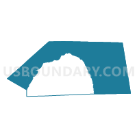
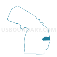
Voting Districts not defined, Huron County, Michigan
About
Outline

Summary
| Unique Area Identifier | 596827 |
| Name | Voting Districts not defined |
| County | Huron County |
| State | Michigan |
| Area (square miles) | 1,298.65 |
| Land Area (square miles) | 0.56 |
| Water Area (square miles) | 1,298.09 |
| % of Land Area | 0.04 |
| % of Water Area | 99.96 |
| Latitude of the Internal Point | 43.94441270 |
| Longtitude of the Internal Point | -82.70590610 |
Maps

Graphs
Select a template below for downloading or customizing gragh for Voting Districts not defined, Huron County, Michigan


Neighbors
Neighoring Voting District (by Name) Neighboring Voting District on the Map
- Voting District 0631378000001, Huron County, MI
- Voting District 0632712000001, Huron County, MI
- Voting District 0633308000001, Huron County, MI
- Voting District 0633646000001, Huron County, MI
- Voting District 0633996000001, Huron County, MI
- Voting District 0634002000001, Huron County, MI
- Voting District 0634430000001, Huron County, MI
- Voting District 0635036000001, Huron County, MI
- Voting District 0636518000001, Huron County, MI
- Voting District 0636570000001, Huron County, MI
- Voting District 0637014000001, Huron County, MI
- Voting District 0637126000001, Huron County, MI
- Voting District 0637220000001, Huron County, MI
- Voting District 0637316000001, Huron County, MI
- Voting District 1512138000001, Sanilac County, MI
- Voting District 1570072000001, Tuscola County, MI
- Voting Districts not defined, Iosco County, MI
- Voting Districts not defined, Bay County, MI
- Voting Districts not defined, Arenac County, MI
- Voting Districts not defined, Sanilac County, MI
- Voting Districts not defined, Tuscola County, MI
Top 10 Neighboring County Subdivision (by Population) Neighboring County Subdivision on the Map
- Sebewaing township, Huron County, MI (2,724)
- Caseville township, Huron County, MI (2,570)
- Harbor Beach city, Huron County, MI (1,703)
- Akron township, Tuscola County, MI (1,503)
- Port Austin township, Huron County, MI (1,424)
- Sand Beach township, Huron County, MI (1,221)
- Fairhaven township, Huron County, MI (1,107)
- Sims township, Arenac County, MI (1,095)
- Sherman township, Huron County, MI (1,083)
- Whitney township, Arenac County, MI (1,001)
Top 10 Neighboring Place (by Population) Neighboring Place on the Map
- Sebewaing village, MI (1,759)
- Harbor Beach city, MI (1,703)
- Caseville village, MI (777)
- Port Austin village, MI (664)
- Bay Port CDP, MI (477)
- Port Hope village, MI (267)
Top 10 Neighboring Unified School District (by Population) Neighboring Unified School District on the Map
- Tawas Area Schools, MI (11,054)
- Standish-Sterling Community School District, MI (10,351)
- Elkton-Pigeon-Bay Port Schools, MI (7,015)
- Unionville-Sebewaing Area School District, MI (5,531)
- Harbor Beach Community Schools, MI (4,585)
- North Huron School District, MI (3,842)
- Au Gres-Sims School District, MI (3,498)
- Caseville Public Schools, MI (2,311)
- Port Hope Community Schools, MI (1,068)
- School District Not Defined (Water), MI (243)
Top 10 Neighboring State Legislative District Lower Chamber (by Population) Neighboring State Legislative District Lower Chamber on the Map
- State House District 96, MI (91,648)
- State House District 84, MI (88,847)
- State House District 97, MI (88,640)
- State House District 83, MI (88,414)
- State House District 103, MI (86,884)
Top 10 Neighboring State Legislative District Upper Chamber (by Population) Neighboring State Legislative District Upper Chamber on the Map
Top 10 Neighboring 111th Congressional District (by Population) Neighboring 111th Congressional District on the Map
- Congressional District 10, MI (719,712)
- Congressional District 1, MI (650,222)
- Congressional District 5, MI (635,129)
Top 10 Neighboring Census Tract (by Population) Neighboring Census Tract on the Map
- Census Tract 9512, Huron County, MI (4,007)
- Census Tract 9508, Huron County, MI (3,484)
- Census Tract 9507, Huron County, MI (3,459)
- Census Tract 2, Tuscola County, MI (3,245)
- Census Tract 9704, Arenac County, MI (2,959)
- Census Tract 9503, Huron County, MI (2,356)
- Census Tract 9505, Huron County, MI (2,319)
- Census Tract 9502, Huron County, MI (2,237)
- Census Tract 9701, Sanilac County, MI (1,866)
- Census Tract 9501, Huron County, MI (1,388)
Top 10 Neighboring 5-Digit ZIP Code Tabulation Area (by Population) Neighboring 5-Digit ZIP Code Tabulation Area on the Map
- 48441, MI (4,085)
- 48759, MI (3,293)
- 48755, MI (3,110)
- 48725, MI (2,464)
- 48467, MI (2,337)
- 48767, MI (2,162)
- 48468, MI (1,294)
- 48720, MI (1,042)